
Special Offer
Create your Memories at the D&SNGRR
Exploring the Durango, Colorado area? Do you know what the current fire restrictions are and road or trail closures? Finding the most up-to-date conditions can be challenging based on where you're going to be traveling.
This page should help clear up the current status of the area you're thinking about exploring.
readylaplata.org - Current evacuation information
app.watchduty.org - Real time wild fire map
Good question!
The current restrictions for the area you're going ultimately depends on who's in charge of the forest you're in! Reference the map below to see what group or agency is in charge of the area you're traveling in.
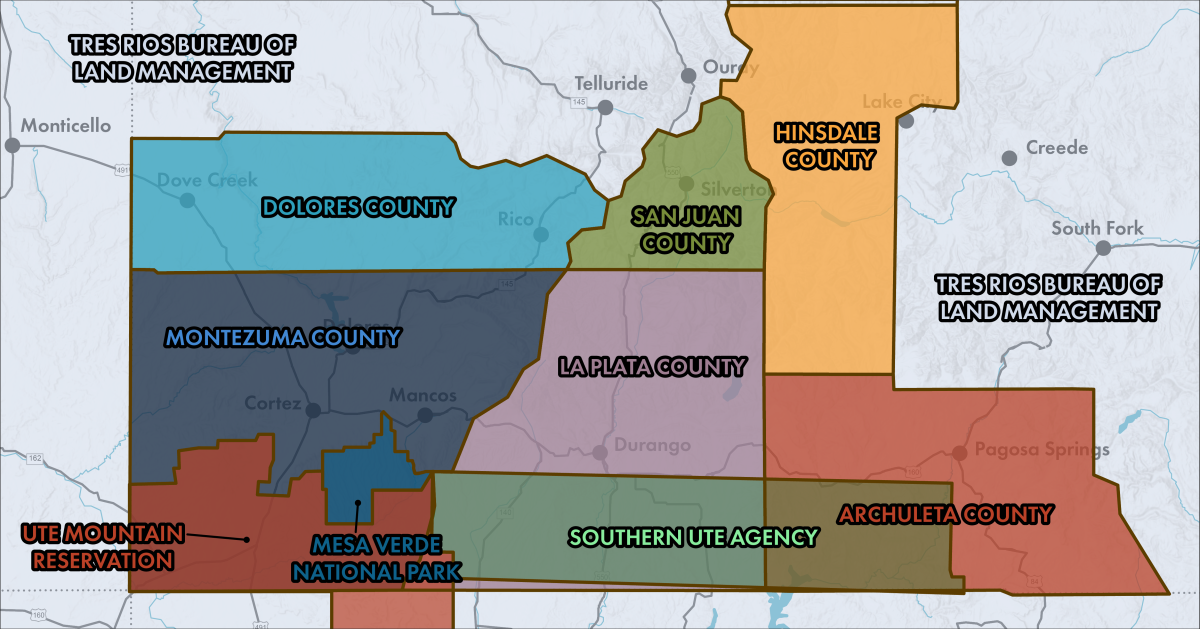
Once you find where you're going on the map and what group manages the area, then you can look to see what the current fire restrictions and closures there by that group.
Remember, some areas may be managed by multiple groups. Be sure to check fire restrictions and closures for each managing group, as they may vary depending on the organization.


