Tracks Across Borders Byway
Byway Distance: 125 miles (89 miles in Colorado) Suggested time: Allow 4 to 5 hours
The Railroad system plays a large part in the route of the Tracks Across Borders Byway; it follows the route of the historical 1880s Denver & Rio Grande Narrow Gauge Railroad San Juan Extension, Colorado's first and the Nation's largest narrow -gauge railroad system. The Byway travels along two states, two Native American cultures, across ancient and historic time, and varied communities of the present day. The Byway’s primary feature is one of Colorado’s greatest stories; the creation and development of the state’s first, and ultimately the nation’s largest, narrow gauge railroad system - the Denver and Rio Grande Railroad (D&RG).
The greatest significances of this corridor today, is the connection of the Durango & Silverton Narrow Gauge Railroad (D&SNGRR) in Durango Colorado to the Cumbres & Toltec Scenic Railroad (C&TSRR) in Chama New Mexico and the fact that it connects the sovereign nations of the Jicarilla Apache in New Mexico and the Southern Ute in Colorado. The Byway passes through the Southern Ute Indian Tribe reservation land, skirting the north end of Navajo Lake, a little-known environmental and recreational gem in the Colorado and New Mexico State Parks systems. Chimney Rock National Monument is an essential thematic feature of national significance on the Byway. The round-trip spur provides access and increased exposure to the unparalleled natural beauty to one of America's newest National Monuments with deep roots in Chaco period significance.
The Utes are the oldest continuous residents of Colorado. Two of the seven original Ute bands, the Mouache and Capote, make up the present day Southern Ute Indian Tribe. They reside on approximately 800,000 acres in southern Colorado. The Jicarilla Tribe consists of two bands: the Llaneros, or plains people, and the Olleros, or mountain valley people. They once roamed a large part of northeastern New Mexico and southern Colorado. In 1887, they were given a permanent reservation in north central New Mexico, which now encompasses one million acres.
J-9 now parallels or overlays about ten miles of the old railroad bed from Dulce northeast to the Colorado border. Most of the original track has been removed, but a short segment remains at the junction of US 64 and J-9 (called Narrow Gauge Street here) in Dulce. Two old D&RGW wooden boxcars sit next to the Jicarilla Culture Center. Several yellow frame buildings with rust trim along the road in town were obviously associated with the D&RGW, but they have second careers as tribal administration buildings.
In 1935 the San Juan Branch stopped operation for freight shipment completely, in 1951 it discontinued daily passenger service, and in 1968 it was abandoned between Chama and Durango. The Cumbres-Toltec and Durango-Silverton lines, which continue in operation today as tourist lines, are all that remain of the San Juan Branch. It doesn’t take a railroad buff to enjoy the sound of a steam engine and the rhythmic clack of wheels on the narrow gauge, and the mountain scenery is enchanting.
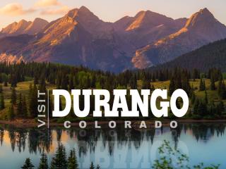
- Durango, drive east on U.S. 160; get your camera ready for breathtaking views of the snow-flecked La Plata Mountain Range. Then, head toward Ignacio on CO Hwy. 172.
- If you have time, Ignacio’s Sky Ute Casino is also a worthy stop. Operated by the Southern Ute Indian Tribe, the casino has a variety of slots and table games, four restaurants, including a delicious steakhouse, and lodging accommodations
- From Ignacio, take Hwy. 151 to Arboles. Chimney Rock National Monument, located less than 25 miles from Arboles off Hwy. 151, is a must-see. The monument, known for its twin rock structures, was once home to the ancestors of the modern Pueblo Indians and boasts more than 200 ancient homes and ceremonial structures. Explore the visitor cabin and take a guided walking tour of the area (offered mid-May through September).
- Arboles will be the final Centennial State stop before you drive south on Archuleta County Roads 500 and 551 east and south into New Mexico. Resplendent Navajo Lake, the chief attraction in Navajo State Park, is nestled on the border between Colorado and New Mexico. The 15,000-acre reservoir’s sapphire waters hug flat-topped buttes and canyons, and the picturesque expanse is a prime fishing, boating, camping and wildlife-watching destination.
- In New Mexico, the motorway becomes Rio Arriba County Road, which leads travelers east to Dulce, home to jagged mesas and the Jicarilla Apache Nation. From here, hop on U.S. 64 east to Chama.
- While Tracks Across Borders Scenic Byway ends in Chama, your journey doesn’t have to. Climb aboard the Antonito, Colorado - bound Cumbres & Toltec Scenic Railroad for a 64-mile journey across 10,000-foot Cumbres Pass. The excursion, which abounds with photo-worthy panoramas, includes a stop in Osier for lunch and a bus back to your car in Chama.
Byway Distance: 125 miles (89 miles in Colorado)
Suggested time: Allow 4 to 5 hours